Hinunangan
(Redirigido desde «Hinunangan, Southern Leyte»)
Hinunangan | |
|---|---|
Municipalidad | |
 | |
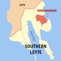
 Mapa de Southern Leyte con Hinunangan resaltado | |
 | |
| Coordenadas: 10°24'N, 125°12'E | |
| Nación | Filipinas |
| Región | Visayas Oriental (Región VIII) |
| Provincia | Southern Leyte |
| Número de barangay | 40 |
| Gobierno | |
| • Type | consejo municipal |
| • Electorado | Error en la secuencia de órdenes: la función «getValue» no existe. votantes (9 Mayo 2022) |
| Superficie | |
| • Total | 170,58 km2 (65,86 sq mi) |
| Elevation | 4,8 m (15,7 ft) |
| Populación (1 Mayo 2020) | |
| • Total | 29,149 |
| • Densidad | 0,17/km2 (0,44/sq mi) |
| • Hogares | 7,402 |
| Economía | |
| • Clase de ingresos | el tercera clase clase de municipalidad |
| • Incidencia de la pobreza | Error en la secuencia de órdenes: la función «getValue» no existe.% (Error: fecha y hora no válidas.)[2] |
| • Ingresos | ₱ <strong4a4df3e5">Error (Error: fecha y hora no válidas.) |
| • Activos | ₱ <strong4a4df3e5">Error (Error: fecha y hora no válidas.) |
| • Pasivos | ₱ <strong4a4df3e5">Error (Error: fecha y hora no válidas.) |
| • Gastos | ₱ <strong4a4df3e5">Error (Error: fecha y hora no válidas.) |
| Huso horario | UTC+8 (PST) |
| Código postal | 6608 |
| PSGC | |
| Código telefonico | 53 |
| Lenguaje nativo | dialecto boholano Cebuano Tagalog |
Hinunangan el tercera clase clase de municipalidad na provincia de Southern Leyte, Filipinas. Tiene este zona de 170.58 kilometro cuadrado.
Comporme del 1 Mayo 2020 censo este tiene papulidad de 29,149 personas y 7,402 hogares. El designada codigo postal 6608 y PSGC 086403000.
Barangay
revisa
|
|
|
Demografía
revisa| Año | Populación | ±% p.a. |
|---|---|---|
| 1903 | 8574 | — |
| 1918 | 11 491 | +1.97% |
| 1939 | 16 983 | +1.88% |
| 1948 | 17 556 | +0.37% |
| 1960 | 12 665 | −2.68% |
| 1970 | 16 142 | +2.45% |
| 1975 | 18 648 | +2.94% |
| 1980 | 20 568 | +1.98% |
| 1990 | 22 454 | +0.88% |
| 1995 | 22 170 | −0.24% |
| 2000 | 25 016 | +2.62% |
| 2007 | 27 712 | +1.42% |
| 2010 | 28 415 | +0.92% |
| 2015 | 29 976 | +1.02% |
| 2020 | 29 149 | −0.55% |
| Ref: Autoridad de Estadísticas de Filipinas[3][4][5][6] | ||
Referencias
revisa- ↑ «Province: Southern Leyte». PSGC Interactive. Quezon City, Philippines: Philippine Statistics Authority. Consultado el Diciembre 17, 2016.
- ↑ «PSA Releases the 2021 City and Municipal Level Poverty Estimates» (2 Abril 2024).
- ↑ Census of Population (2015). "Region VIII (Eastern Visayas)". Total Population by Province, City, Municipality and Barangay. Philippine Statistics Authority.
- ↑ Census of Population and Housing (2010). "Region VIII (Eastern Visayas)". Total Population by Province, City, Municipality and Barangay. NSO.
- ↑ Censuses of Population (1903–2007). "Region VIII (Eastern Visayas)". Table 1. Population Enumerated in Various Censuses by Province/Highly Urbanized City: 1903 to 2007. NSO.
- ↑ «Province of Southern Leyte». Municipality Population Data. Local Water Utilities Administration Research Division. Consultado el Diciembre 17, 2016.
Enlaces externos
revisa| Provincia de Southern Leyte | |
| Maasin (cabecera) | |
| Municipalidad: | Anahawan ▪ Bontoc ▪ Hinunangan ▪ Hinundayan ▪ Libagon ▪ Liloan ▪ Limasawa ▪ Macrohon ▪ Malitbog ▪ Padre Burgos ▪ Pintuyan ▪ Saint Bernard ▪ San Francisco ▪ San Juan ▪ San Ricardo ▪ Silago ▪ Sogod ▪ Tomas Oppus |
| Ciudad: | Maasin |