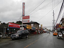
San Juan, Batangas
San Juan | |
|---|---|
Municipalidad | |
 | |
 Mapa de Batangas con San Juan resaltado | |
 | |
| Coordenadas: 13°49'34"N, 121°23'46"E | |
| Nación | Filipinas |
| Región | Calabarzon (Región IV-A) |
| Provincia | Batangas |
| Número de barangay | 42 |
| Fundación | 12 Diciembre 1848 |
| Gobierno | |
| • Type | consejo municipal |
| • Electorado | Error en la secuencia de órdenes: la función «getValue» no existe. votantes (9 Mayo 2022) |
| Superficie | |
| • Total | 273,40 km2 (105,56 sq mi) |
| Elevation | 23 m (75 ft) |
| Populación (1 Mayo 2020) | |
| • Total | 114,068 |
| • Densidad | 0,42/km2 (1,1/sq mi) |
| • Hogares | 27,553 |
| Economía | |
| • Clase de ingresos | el primera clase de municipalidad |
| • Incidencia de la pobreza | Error en la secuencia de órdenes: la función «getValue» no existe.% (Error: fecha y hora no válidas.)[2] |
| • Ingresos | ₱ <strong4a4df3e5">Error (Error: fecha y hora no válidas.) |
| • Activos | ₱ <strong4a4df3e5">Error (Error: fecha y hora no válidas.) |
| • Pasivos | ₱ <strong4a4df3e5">Error (Error: fecha y hora no válidas.) |
| • Gastos | ₱ <strong4a4df3e5">Error (Error: fecha y hora no válidas.) |
| Huso horario | UTC+8 (PST) |
| Código postal | 4226 |
| PSGC | |
| Código telefonico | 43 |
| Lenguaje nativo | Tagalog |
| Website | http://www.sanjuanbatangas.gov.ph/ |
San Juan el primera clase de municipalidad na provincia de Batangas, Filipinas. Tiene este zona de 273.40 kilometro cuadrado.
Comporme del 1 Mayo 2020 censo este tiene papulidad de 114,068 personas y 27,553 hogares. El designada codigo postal 4226 y PSGC 041023000.
Barangay
revisa
|
|
|
Demografía
revisa| Año | Populación | ±% p.a. |
|---|---|---|
| 1903 | 11 853 | — |
| 1918 | 13 553 | +0.90% |
| 1939 | 24 837 | +2.93% |
| 1948 | 28 642 | +1.60% |
| 1960 | 36 220 | +1.98% |
| 1970 | 47 101 | +2.66% |
| 1975 | 52 936 | +2.37% |
| 1980 | 59 345 | +2.31% |
| 1990 | 67 741 | +1.33% |
| 1995 | 71 913 | +1.13% |
| 2000 | 78 169 | +1.80% |
| 2007 | 87 276 | +1.53% |
| 2010 | 94 291 | +2.85% |
| 2015 | 108 585 | +2.72% |
| 2020 | 114 068 | +0.97% |
| Ref: Autoridad de Estadísticas de Filipinas[3][4][5][6] | ||
Referencias
revisa- ↑ «Province: Batangas». PSGC Interactive. Quezon City, Philippines: Philippine Statistics Authority. Consultado el Diciembre 17, 2016.
- ↑ «PSA Releases the 2021 City and Municipal Level Poverty Estimates» (2 Abril 2024).
- ↑ Census of Population (2015). "Region IV-A (Calabarzon)". Total Population by Province, City, Municipality and Barangay. Philippine Statistics Authority.
- ↑ Census of Population and Housing (2010). "Region IV-A (Calabarzon)". Total Population by Province, City, Municipality and Barangay. NSO.
- ↑ Censuses of Population (1903–2007). "Region IV-A (Calabarzon)". Table 1. Population Enumerated in Various Censuses by Province/Highly Urbanized City: 1903 to 2007. NSO.
- ↑ «Province of Batangas». Municipality Population Data. Local Water Utilities Administration Research Division. Consultado el Diciembre 17, 2016.
Enlaces externos
revisa- PhilAtlas.com
- Philippine Standard Geographic Code
- Local Governance Performance Management System
- www
.sanjuanbatangas .gov .ph
| Provincia de Batangas | |
| Ciudad de Batangas (cabecera) | |
| Municipalidad: | Agoncillo ▪ Alitagtag ▪ Balayan ▪ Balete ▪ Bauan ▪ Calaca ▪ Calatagan ▪ Cuenca ▪ Ibaan ▪ Laurel ▪ Lemery ▪ Lian ▪ Lobo ▪ Mabini ▪ Malvar ▪ Mataasnakahoy ▪ Nasugbu ▪ Padre Garcia ▪ Rosario ▪ San Jose ▪ San Juan ▪ San Luis ▪ San Nicolas ▪ San Pascual ▪ Santa Teresita ▪ Taal ▪ Talisay ▪ Taysan ▪ Tingloy ▪ Tuy |
| Ciudad: | Ciudad de Batangas ▪ Lipá ▪ Santo Tomas ▪ Tanauan |
